Epic Air Drone Operator Kathu is a Aerial photographer establishment in Kathu, Northern Cape, South Africa
Epic Air Drone Operator Kathu: Aerial Photography and Aerial Data Specialists
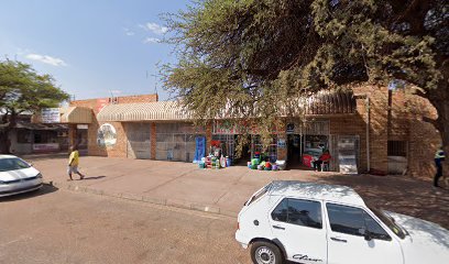
Epic Air Aerial Services, a fully licensed and insured UAV operator, presents itself as a versatile provider of aerial photography, surveying, and inspection solutions across South Africa. While rooted in Cape Town, the company emphasises its capacity to deliver high-quality drone data and imagery quickly, safely and at competitive rates for projects in urban, agricultural and industrial environments. The firm holds SACAA ROC Nr: G1336D, underscoring its commitment to regulatory compliance and professional practice in the field of unmanned aviation.
In the Kathu area and broader Northern Cape, Epic Air positions itself as a principal source of aerial capabilities for a range of industries. The services described on the company’s website cover three core areas: aerial data services (surveying and mapping), inspections (asset and infrastructure surveys), and film & media (aerial photography and videography). Each service line is characterised by a focus on accuracy, safety and efficiency, designed to support informed decision-making and streamlined project delivery.
Main services offered
- <strongAerial Drone Surveying and Mapping – This includes aerial surveying, mapping and topographic work, with capabilities described for mine surveying, construction surveys, and engineering surveys. The offerings emphasise the creation of detailed maps and 3D models derived from photogrammetry, enabling precise measurements, planning and monitoring of projects in difficult-to-access locations.
- <strongAerial Drone Inspections – A broad set of inspection services targets infrastructure and assets. Typical applications highlighted include wind turbines, solar panels, roofs, structural elements of buildings and bridges, power lines, cell towers, and other critical assets. The emphasis is on safe, high-resolution data capture that supports fault detection, maintenance planning and asset integrity assessments.
- <strongFilm and Media – The business highlights aerial photography and videography for film and media production, offering dynamic camera positioning and movement to enhance production value and storytelling from airborne perspectives.
Typical job types and industries
The company describes sectors that commonly benefit from its drone services, including renewable energy (wind and solar farms), mining, construction, real estate and property management, utilities, telecoms, and media. Specific applications include inspecting wind turbines and solar arrays for performance and safety, surveying mining sites for accurate data and planning, and providing high-quality aerial footage and imagery for media productions. Drone-based inspections are framed as safer, faster, and more efficient than traditional on-the-ground methods, particularly for high structures, elevated assets and hazardous environments.
How requests usually work
Epic Air presents a straightforward process for engaging its services. A formal quote can be requested through the company’s online portal. Once a project is discussed, clients typically receive a plan that includes flight planning, regulatory compliance, data capture, and delivery of usable outputs. The service model emphasises turnkey data and footage that are safe, legal and insured, with experienced pilots and safety-oriented flight planning playing central roles in each engagement.
Practical tips for customers
- Clarify deliverables early: specify whether the project requires high-resolution photography, photogrammetric maps, 3D models, thermal imaging, or video footage, so the flight plan can be tailored accordingly.
- Consider regulatory and safety requirements: ensure that permissions for airspace, site access, and any necessary exemptions are identified ahead of time, given the operator’s SACAA accreditation and safety emphasis.
- Discuss data formats and timelines: confirm preferred file formats (e.g., orthophotos, georeferenced maps, 3D models) and expected turnaround times for data delivery after the flight.
- Plan around weather and lighting: optimal results depend on daylight, visibility and wind conditions; coordinating a suitable window will help maximise data quality and reduce reshoot needs.
- Prepare the site: identify any restricted zones, sensitive assets, or privacy considerations to ensure a smooth operation and compliant data capture.
Hours, location and coverage
Epic Air describes itself as a Cape Town–based aerial services provider offering competitive rates throughout South Africa and abroad. While specific local hours are not listed, the company presents itself as ready to service clients nationwide, including the Kathu area in the Northern Cape, subject to scheduling and project requirements. The emphasis on nationwide capability suggests flexibility to accommodate both on-site and remote project management where feasible.
For those seeking professional aerial photography, surveying, or inspection services in Kathu or the broader Northern Cape, Epic Air presents a regulated, insured option with a comprehensive suite of drone-based data services. The combination of surveying, inspections and media capabilities positions the operator as a broad partner for projects requiring accurate geospatial data, asset monitoring and compelling aerial imagery.
Kathu
Northern Cape
South Africa
Sorry, no records were found. Please adjust your search criteria and try again.
Sorry, unable to load the Maps API.
Aerial photography services in Kathu, Northern Cape
This article provides an overview of aerial photography offerings in Kathu, a town set within the arid landscapes of the Northern Cape. Clients seeking elevated perspectives can expect crews to capture expansive views of mine sites, rural farmlands, and developing properties against the region’s expansive skies. The work typically blends technical drone operation with skilled composition to produce images and footage suitable for marketing, planning, and documentation.
In Kathu, a variety of aerial services are commonly available, reflecting the local economic mix that includes mining, property development, and tourism. Aerial photographers often specialise in drone photography for site surveys, progress documentation on construction or mining projects, and high-end marketing footage for real estate or commercial developments. Beyond still imagery, many providers offer aerial video sequences, 360-degree panoramas, and post-production services such as colour grading and advanced retouching. The resulting deliverables usually include high-resolution photographs and video clips suitable for reports, brochures, websites, and social media campaigns.
Prospective clients can expect a clear process from initial enquiry to delivery. Initial discussions typically cover project objectives, preferred formats, and the required altitudes or shot angles. A site-risk assessment is common in Northern Cape conditions, with considerations given to heat, wind, and open terrain. The photographic plan may include a mix of overhead shots that showcase scale, close-up imagery for detail, and aerial walkthroughs that guide viewers through a site or landscape. Ethical and privacy considerations are observed, particularly near residential areas or sensitive sites.
Practical considerations play a central role in successful bookings. Local weather can influence flight schedules, with hot days and gusty winds requiring flexible timing. Equipment reliability, including drones equipped with stabilised cameras and appropriate filers for desert light, is essential. Operators often carry backup batteries, spare props, and weather-resistant cases to cope with environmental conditions. In many cases, contracts outline the number of flight hours, flight permissions, data ownership, and the format of final outputs. Clear communication helps ensure that delivery timelines align with project milestones, whether for a short shoot or a longer-term monitoring campaign.
Safety and regulatory compliance form a core aspect of service in Kathu. Operators adhere to general aviation guidelines, obtain any necessary permissions for airspace use, and ensure safe operation around people and property. Basic guidance on privacy and consent may accompany shoots near private lands or communities. Clients benefit from working with photographers who can interpret local terrain and light conditions—particularly the bright, sunlit days common in the Northern Cape—while delivering footage that remains usable across different platforms and weather scenarios.
A typical client engagement in this region might involve a preliminary site visit or a detailed briefing, followed by a scheduled flight plan, on-site capture, and post-production editing. The result is a curated set of images and video assets ready for inclusion in marketing materials, project documentation, or corporate presentations. For those commissioning aerial photography in Kathu, the focus is often on illustrating scale, showcasing development potential, and communicating a narrative about landforms, infrastructure, or mining operations with a distinctive, elevated viewpoint.
- Drone photography for site surveys and progress updates
- Aerial videography, including 4K or higher resolution footage
- Panoramic and 360-degree imagery for immersive presentations
- Post-production services such as colour correction and montage editing
- Deliverables in high-resolution formats suitable for print and digital use