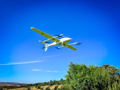
3DroneMapping is a Surveyor establishment in Camperdown, Kwa-Zulu Natal, South Africa
Kwa-Zulu Natal
South Africa
Sorry, no records were found. Please adjust your search criteria and try again.
Sorry, unable to load the Maps API.
Surveyor Services in Camperdown, Kwa-Zulu Natal
In Camperdown, a region within Kwa-Zulu Natal characterised by a mix of rural land and developing residential pockets, surveyor services provide essential support for property ownership, development, and land management. Clients can expect professional guidance through the stages of measurement, mapping, and practical decision-making that underpin successful property transactions and construction projects.
Surveying practice in Camperdown typically encompasses a range of core activities. Boundary and title surveys establish precise property lines, helping owners understand their rights and responsibilities while reducing the risk of disputes with neighbouring plots. Topographic surveys capture the terrain, existing structures, vegetation, drainage, and other site features, informing planning and design processes for building projects or landscape work. For developers and planners, cadastral mapping and spatial records support subdivision, consolidation, or changes in land use, closely aligning with municipal requirements and land register updates.
Construction-related services form another important pillar. Layout or construction staking translates design plans into real-world markers on the ground, ensuring buildings, roads, and other features are positioned correctly during excavation and erection. In areas with varying terrain or older infrastructure, surveyors may perform as-built surveys to document the as-constructed state of a site, which can differ from initial designs due to site conditions or changes during construction. When projects involve retained earthworks, drainage channels, or problem-prone soils, specialist advice on grading, elevations, and drainage patterns helps mitigate future issues.
Surveyors in Camperdown often work closely with property lawyers, estate developers, building contractors, and municipal authorities. Clients can expect clear communication about what is feasible within planning constraints, what documentation is required for permits, and how survey data integrates with existing land records. Digital plans and drawings are commonly produced, with notes and coordinates designed to be compatible with local GIS and planning systems. This collaboration supports smooth approvals, accurate valuer assessments, and reliable records for ongoing maintenance or future development.
Practical considerations are pivotal when engaging surveyor services in this region. Accessibility to a site, including gate access and dog and vehicle control, can influence scheduling and on-site logistics. Weather conditions may affect measurement activities, particularly in exposed or hilly areas; projects are often planned with contingency for rain or strong winds. Terrain variations—from level agricultural land to steep escarpments—can impact the time required for accurate data capture and processing. Clients should consider the potential need for multiple visits if boundaries are ambiguous, if records are incomplete, or if adjoining landowners require collaboration on shared improvements.
Quality survey work in Camperdown typically includes a clear scope of work, detailed plans, and a set of survey coordinates tied to recognised reference systems. While the exact formats may vary, most projects culminate in comprehensive plans suitable for submission to local authorities or for inclusion in property documentation. It is prudent for clients to verify the credentials and experience of the survey professional, request examples of previous local projects, and obtain a transparent explanation of timelines and deliverables before engagement.
Overall, surveyor services in Camperdown equip property owners, developers, and residents with precise information for making informed decisions, reducing risk, and laying a solid foundation for successful land use and construction outcomes in Kwa-Zulu Natal.